
I am a PhD Candidate at the University of Southampton studying compound flooding, multi-hazard risk, and numerical modelling. I enjoy all things relating to environment and technology in support of science-informed decision-making, managagement, and policy.
I am a PhD Candidate at the University of Southampton studying compound flooding, multi-hazard risk, and numerical modelling. I enjoy all things relating to environment and technology in support of science-informed decision-making, managagement, and policy.
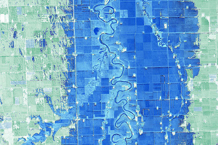
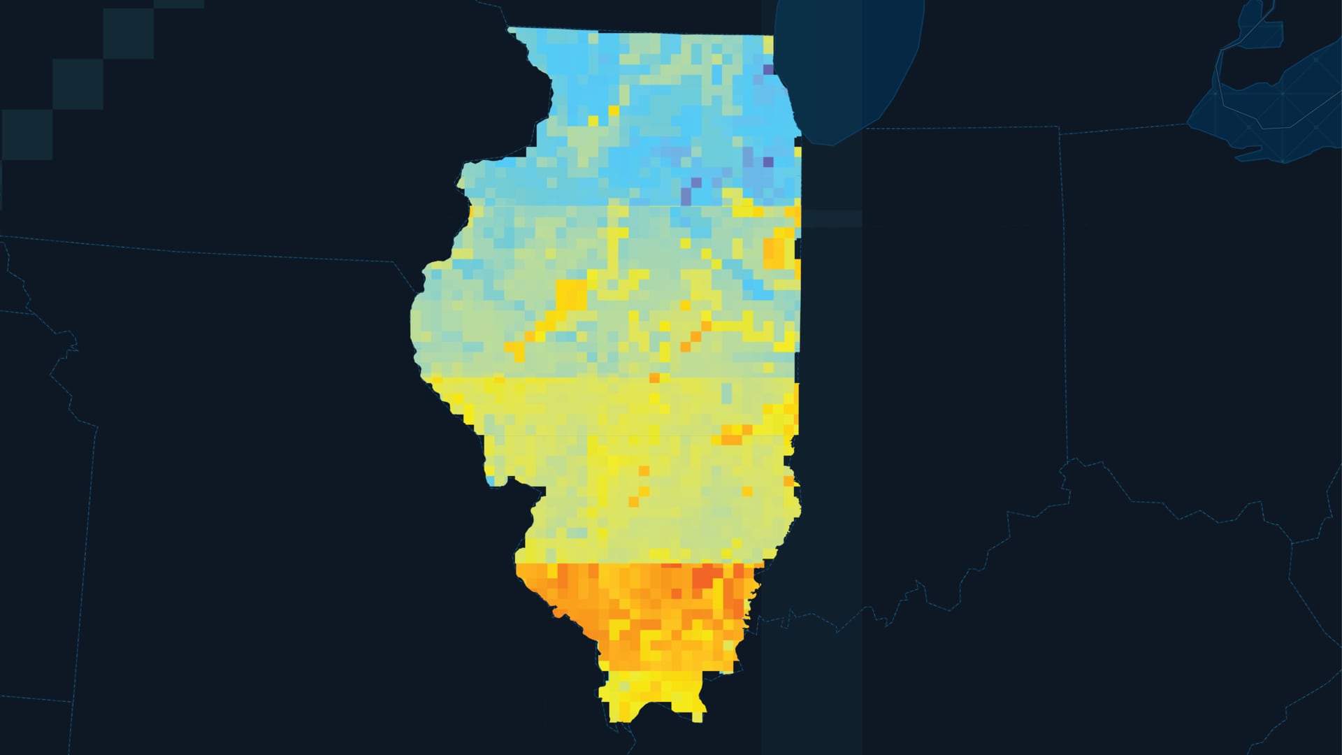
Drought and flooding in Illinois have severe impacts on the communities and ecosystems of the state. Soil moisture is a valuable indicator of drought and flood vulnerability but can be difficult to measure since in situ monitoring is limited to discrete stations throughout the state. The project created a framework to compare in situ (Water and Atmospheric Resources Monitoring; WARM), modeled (SPoRT Land Information System; SPoRT-LIS), and satellite (Soil Moisture Active Passive; SMAP) measurements to assess the spatial coverage and performance of soil moisture monitoring products.
A rapidly warming Arctic has compromised the structural integrity of critical infrastructure through accelerated permafrost thaw and thermokarst development underlying these areas. Infrastructure, including roads, bridges, and airports across the state of Alaska are particularly at risk, as permafrost underlies ~85% of the state. However, monitoring the impacts of permafrost thaw on infrastructure is largely limited to in situ observations and frequently identified after the damage is evident. In order to assist transportation and infrastructure decision-makers in Alaska, this project identified and quantified areas of surface subsidence near critical infrastructure using Sentinel-1 C-band Synthetic Aperture Radar (SAR) and L-band Uninhabited Aerial Vehicle SAR (UAVSAR) imagery.
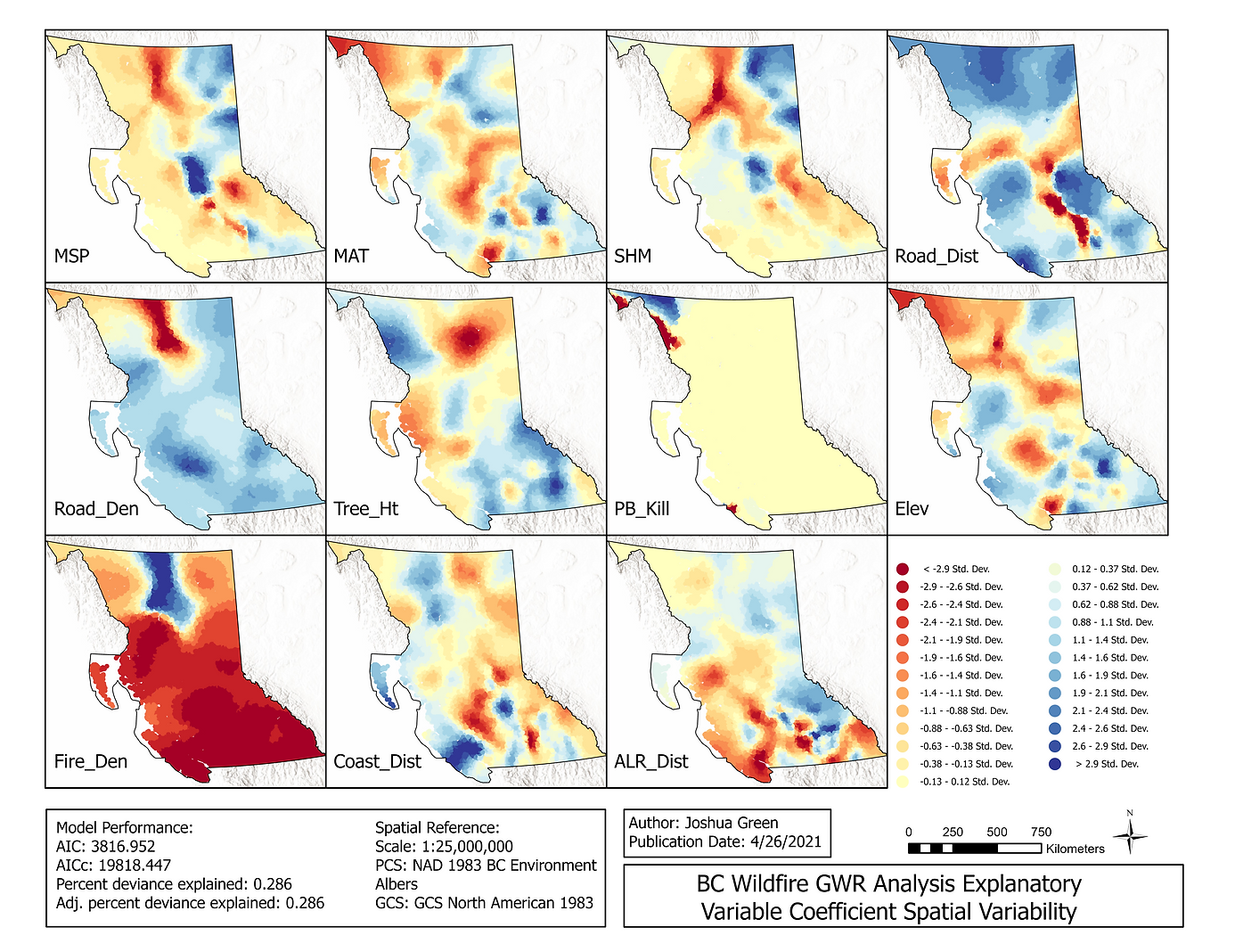
In recent decades the Pacific North West has repeatedly experienced all-time high wildfire events. British Columbia declared states of emergency in both 2017 and 2018 during two record-setting years. It is critical that we understand the factors influencing wildfire events in order to develop efficient strategies for fire management and mitigation. This study used a combination of Ordinary Least Squared (OLS) Linear Regression and Geographically Weighted Regression (GWR) analysis to advance understanding of the spatial relationships of factors driving wildfire events and the spatial distribution of fires in British Columbia.
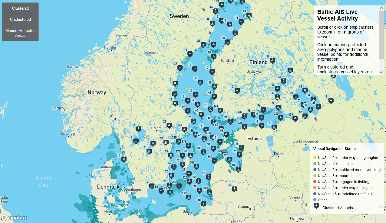
This project monitors marine vessels to identify ships located in MPAs to support the investigation of potential illegal fishing activity or potential environmental harm to protected marine habitats. A webmap displays Marine Protected Area (MPA) and near-realtime marine vessel AIS position/activity information throughout the Baltic Sea. This tool was designed to support monitoring operations by European marine traffic regulators and fishery management authorities such as the European Fisheries Control Agency.